Area Information:
Situated next door to Burham Down Reserve the chalk grassland, scrub and woodland sits high up with panoramic views across to Leybourne and West Malling.
Some of the footpaths form part of the North Downs long distance route and the area contains quite a few steep and uneven paths.
Notice boards and a dog bin can be found next to the car park along with benches and picnic tables. The car park has a height barrier and is closed over night.
Location:
Common Road,
Blue Bell Hill,
Chatham,
Kent,
ME5 9RG
Parking: Small free carpark available (closed overnight)
Facilities:
- – Free car park available in Common Road (Closed overnight. See sign at the entrance for opening and closing times)
- – Picnic tables and benches located around the site.
Circular Walk Information:
Distance: A Circular walk approx 6Km (3.7 Miles)
Time: Approx. 1.5 Hours dependant on pace.
Terrain: Set on a hillside so some paths are steep and uneven. The walk up the Byway is particularly steep. Footpaths can become very muddy in winter and wet weather.
Stiles: None. Only kissing gates.
Dogs on leads?: Dogs allowed off lead.
Dog Bins: Yes. A few can be found around the nature reserve.
Circular Walk Route:
Dog Walk:
There are various routes that can be taken but we started our walk from the car park located in Common Road. Head off across the grassland admiring the view, through the first kissing gate and then out the next kissing gate and follow the footpath down hill until you come to a footpath cross roads. From here the choice is yours, we chose to carry straight on where you eventually come out onto a Byway. If you turn right and follow the steep By way to the top you come out back on Common Road opposite the Robin Hood Pub. You can then either pop into the dog friendly pub, head off down the cycle path next to the pub and into the woods or turn right and take a short walk back along Common Road until you get to another path on your right which will take you back to the footpath cross roads you were at earlier.
Gallery:
-
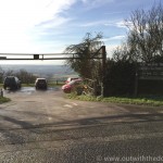
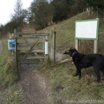
- The entrance to ‘Blue Bell Hill Nature Reserve’
-
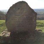
- Memorial stone in memory of the Air Ambulance whose helicopter crashed back in 1998.
-
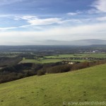
- View from the car park.
-
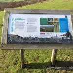
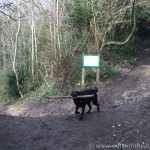
- Information boards are located next to the car park.
-
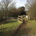
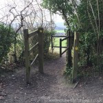
- Kissing gates are located around the reserve and surrounding footpaths.
-
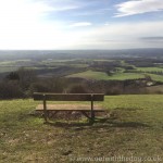
- Enjoy the view from one of the benches.
-
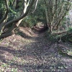
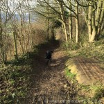
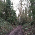
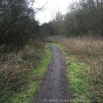
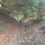
- Some of the footpaths leading away from the nature reserve can be steep and uneven.
-
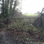
- Turn stile leading out to a footpath towards Burham.
-
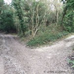
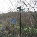
- Which way now?
-
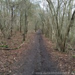
- Still heading down hill.
-
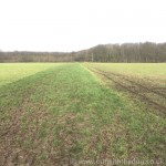
- View across the fields towards Burham
-
- Entrance to another grassland area.
-
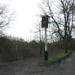
- Footpath meets Byway so be aware of 4×4 vehicles and motorbikes.
-
- The Byway takes you back to the top of the hill and is fairly steep.
-
- When you make it to the top of the Byway you are rewarded with a pub across the lane.
-
- The start of the cycle path accessed near to the Robin Hood Pub.
-
- The cycle path heads down towards Nashenden Down Reserve.
-
- We chose the woodland footpath that heads back towards Blue Bell Hill.
-
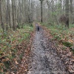
- The walk back up through the woods was very muddy in places.
-
- The end of the woods and out into the open.
-
- Out of the woods and into a field as we head back to Blue Bell Hill.
-
- The Bridal way heads downhill back to the cross roads you passed over earlier.
-
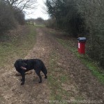
- Dog bins located around the reserve.
-
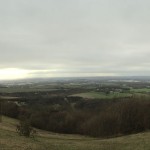
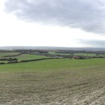
- Panorama view from the top of the hill near the carpark.